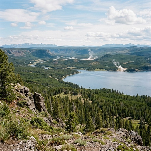
The Geological Dynamics and Subsurface Architecture of the Yellowstone Volcanic System
Abstract Yellowstone National Park overlies one of Earth's largest active silicic volcanic systems. Driven by a deep-mantle hotspot, the Yellowstone magmatic system is characterized by extensive hydrothermal activity, recurrent seismicity, and a history of massive caldera-forming eruptions. Current geophysical models reveal a complex, dual-chamber subsurface architecture that dictates the region's geologic behavior.
Geological History and Plume Dynamics The North American tectonic plate's southwestern movement over a stationary mantle plume has generated a 16-million-year track of volcanism, culminating in the modern Yellowstone Plateau. The system's Pleistocene history is defined by three catastrophic caldera-forming events.
- Huckleberry Ridge Eruption (2.1 Ma): The largest of the three, this event produced the Huckleberry Ridge Tuff, ejecting approximately 2,450 cubic kilometers of volcanic material and forming the Island Park Caldera.
- Mesa Falls Eruption (1.3 Ma): A relatively smaller event that ejected roughly 280 cubic kilometers of material, resulting in the Mesa Falls Tuff and the Henry's Fork Caldera.
- Lava Creek Eruption (0.64 Ma): Ejected approximately 1,000 cubic kilometers of material, creating the Lava Creek Tuff and precipitating the collapse that formed the current 45-by-30-mile Yellowstone Caldera.
Since the Lava Creek event, major volcanic activity has been restricted to smaller effusive rhyolitic lava flows, the most recent of which occurred approximately 70,000 years ago.
Subsurface Magmatic Architecture Recent advancements in seismic tomography and magnetotelluric imaging have provided a high-resolution understanding of Yellowstone's magmatic plumbing system. Contrary to persistent public misconceptions of a contiguous subterranean ocean of magma, the system consists of two distinct, largely crystalline reservoirs containing a distributed fraction of partial melt.
-
Upper Crustal Magma Reservoir (Rhyolitic)
-
Composition: Primarily high-silica rhyolite.
-
Vertical Boundaries: The upper boundary (roof) of this chamber is positioned at a remarkably shallow depth of 3.8 km beneath the surface. Recent artificial seismic wave studies have resolved this upper cap as a sharp boundary characterized by volatile-rich, partially molten rock. The reservoir extends downward, terminating at a bottom boundary depth of approximately 17 km.
-
Melt Fraction: Tomographic velocity models indicate the chamber averages only 5% to 15% partial melt. The remaining 85% to 95% of the reservoir consists of solid, hot, spongelike rock.
-
Lower Crustal Magma Reservoir (Basaltic)
-
Composition: Primarily low-silica basalt, sourced directly from the underlying mantle plume.
-
Vertical Boundaries: This significantly larger reservoir sits deep beneath the upper chamber. Its top boundary is located at a depth of roughly 20 km. It extends through the lower crust, with its bottom boundary situated approximately 45 to 50 km beneath the surface.
-
Melt Fraction: Despite possessing a volumetric capacity roughly 4.5 times greater than the upper chamber, the lower reservoir contains a much lower melt fraction, estimated at approximately 2%.
System Dynamics and Monitoring The basaltic magma in the deep lower reservoir acts as the primary thermal engine for the overlying rhyolitic chamber. The transfer of latent heat and exsolved volatiles across these boundaries sustains the widespread hydrothermal features observed at the surface. The shallow 3.8 km depth of the upper chamber's roof facilitates continuous interactions between magmatic gases (water, sulfur dioxide, carbon dioxide) and meteoric groundwater, driving the thermodynamics of the park's geyser basins.
Deformation monitoring via GPS and satellite radar interferometry (InSAR) demonstrates that the caldera floor undergoes cyclical periods of inflation and deflation. These morphological changes, coupled with periodic earthquake swarms, are primarily attributed to the influx, migration, and pressurization of hydrothermal fluids and volatiles rather than the rapid ascent of magma.
Current seismic models and melt fraction data indicate that the system lacks the requisite accumulation of contiguous, eruptible melt to generate a supereruption in the foreseeable future. The Yellowstone Volcano Observatory (YVO) continuously monitors the system's geodetic, seismic, and geochemical metrics to constrain the physical state of the magma, ensuring that any fundamental shift in subsurface dynamics is detected well in advance.