The Subsurface Architecture of Campi Flegrei: A Geological and Structural Overview
1. Geomorphological and Tectonic Framework
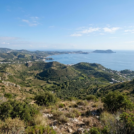
Campi Flegrei is a highly dynamic, nested volcanic caldera complex located within the Campanian Volcanic Arc along the Tyrrhenian passive margin of Italy. Geographically centered at 40.827°N, 14.139°E, the structural system forms a circular spatial depression spanning approximately 12 to 15 kilometers in diameter. The caldera is topographically bisected: its northern sector is subaerially exposed across western Naples and Pozzuoli, whereas its southern sector is subaqueously localized beneath the Gulf of Pozzuoli.
The regional tectonic setting is controlled by back-arc rifting and lithospheric extension, driven by the eastward migration of the Apennine subduction system. This extensional stress field generated a dense network of normal faults, resulting in a graben structure within Mesozoic carbonate platforms. This structural plumbing network has facilitated protracted trachybasaltic to trachyphonolitic magmatism throughout the Late Pleistocene and Holocene epochs.
2. Chronostratigraphy and Eruptive History
The evolutionary lifespan of Campi Flegrei is defined by major ignimbrite-forming collapses interspersed with periods of localized effusive and phreatomagmatic activity. Chronostratigraphic records divide this active history into three primary phases:
-
The Campanian Ignimbrite (CI) Event (~39,000–40,000 ka): This catastrophic eruption initiated the primary structural caldera collapse. Thermobarometric data and ash-layer models estimate that the event extruded approximately 150 to 200 km³ of phonolitic-trachytic magma, corresponding to a bulk tephra volume exceeding 500 km³. The resulting pyroclastic density currents covered an area greater than 30,000 km² across the Campanian plain, causing a widespread regional collapse that established the outer boundaries of the modern caldera.
-
The Neapolitan Yellow Tuff (NYT) Event (~15,000 ka): A secondary structural modification occurred during this phreatomagmatic event, which evacuated roughly 40 km³ of trachyphonolitic material. The interaction between ascending magma and shallow aquifers induced intense fragmentation, depositing extensive layers of lithified palagonitised yellow tuff. This eruption caused a secondary, nested caldera collapse centered beneath the modern Pozzuoli Bay, defining the inner topographic depressions seen today.
-
Holocene Localized Volcanism: Post-NYT activity consists of localized eruptions from monogenetic vent clusters. This phase concluded with the historical, low-volume eruption of Monte Nuovo in 1538 CE. This event constructed a 133-meter-high cinder cone over a six-day period, ending 3,000 years of structural quiescence and forming the youngest structural feature inside the caldera rim.
3. Bradyseismic Dynamics and Hydrothermal Coupling
The modern hazard profile of the caldera is dominated by bradyseism, a phenomenon characterized by large-scale, episodic vertical ground deformation unaccompanied by immediate volcanic eruptions. Since 2005, the central zone of the caldera has experienced a continuous acceleration phase, resulting in a cumulative vertical uplift exceeding 1.4 meters by 2026.
Geophysical inversions indicate that this deformation is driven by a dual-source engine. While long-term elastic stress fields are sustained by periodic magmatic injections at depth, short-term strain variations are heavily modulated by the overpressurization of the shallow hydrothermal system. Highly compressed magmatic gases—primarily CO₂ and H₂O—ascend along vertical faults, vaporizing deep aquifers and generating mechanical strains that fracture the brittle shallow crust.
4. Anatomy of the Magmatic Plumbing System
Seismic tomography, magnetotelluric (MT) soundings, and melt-inclusion barometry reveal a stratified, multi-tiered magmatic plumbing system beneath Campi Flegrei. Subsurface magma storage is distributed between two primary complexes defined by clear vertical boundaries.
The Shallow Accumulation Complex (Sill System)
The uppermost magmatic storage zone is located within the shallow crust. It is constrained by a top vertical boundary at approximately 3.0 to 3.5 km depth and a bottom vertical boundary at roughly 4.5 to 5.0 km depth. Rather than a singular spherical chamber, this reservoir consists of a dynamic plexus of laterally extensive, interconnected sills composed of differentiated trachyphonolitic and trachytic melt.
The roof of this shallow complex sits directly beneath a distinct thermo-metamorphic and mechanical transition zone situated at 2.5 to 3.0 km depth, composed of high-velocity, consolidated skarn and hydrothermally altered tuff. This high-velocity horizon acts as a structural filter that frequently stalls ascending magmatic dikes. Geodetic data inversions from historical (1982–1984) and ongoing unrest episodes locate the source of volume expansion precisely within this 3.5 to 4.5 km depth interval. Melt inclusion barometry shows that the magmas within this layer are highly evolved, volatile-saturated, and undergo continuous fractional crystallization.
The Deep Regional Magma Chamber (Mush Zone)
The primary feeding source of the volcanic system is a deep-seated, regional magmatic reservoir. Geophysical modeling constraints define the top boundary (roof) of this deep reservoir at 7.5 to 8.5 km depth. This depth corresponds to a prominent sub-horizontal seismic reflection horizon where seismic waves decelerate sharply. Specifically, shear-wave velocity ($V_s$) drops from a background crustal value of ~3.6 km/s to less than 1.0 km/s, marking a zone of extreme partial melting estimated between 10% and 80% melt fraction.
The bottom vertical boundary of this deep system extends past 20.0 km depth, plunging through the lower crust and tracking into the upper mantle transition zone. Three-dimensional magnetotelluric and seismic tomography datasets confirm that this deep asset forms a massive, continuous crystal mush zone of primitive trachybasaltic and shoshonitic composition. Furthermore, cross-caldera tomographic imaging reveals that at the 8.0 to 9.0 km depth interval, this deep magmatic plexus forms a lateral structural connection with the plumbing system of neighboring Mount Vesuvius, suggesting a shared deep-seated source of regional crustal melting.
5. Structural and Volcanological Synthesis
The thermodynamic equilibrium of Campi Flegrei depends on the continuous mass and heat transfer between its two primary storage volumes. Primitive, CO₂-rich magma accumulates within the deep reservoir past 7.5–8.5 km depth, releasing volatile phases that ascend through the crustal fault networks. When tectonic stresses or hydrothermal overpressure thresholds exceed the tensile strength of the host rock, magma batches migrate upward from the deep reservoir, replenishing the shallow sill complex located between 3.0 and 5.0 km depth. Delineating these precise vertical boundaries is critical for structural stress modeling and predictive volcanology.