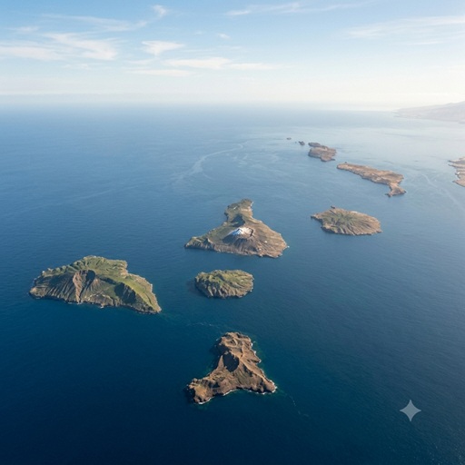
The Geotectonic Evolution and Hazard Assessment of the Canary Island Seamount Province
Introduction
The Canary Islands comprise a volcanic archipelago situated in the eastern Central Atlantic Ocean, approximately 100 kilometers off the northwestern passive continental margin of the African plate. Consisting of seven major islands and numerous submerged seamounts, the archipelago represents a premier geological laboratory for the study of intraplate oceanic volcanism. Characterized by prolonged alkaline magmatism, the islands are the surface expression of complex interactions between deep-mantle thermal anomalies and regional tectonic structures.
Geotectonic Framework and Petrogenesis
The Canary Island Seamount Province rests upon Jurassic-era oceanic crust, estimated to be between 150 and 180 million years old. Unlike island arcs formed at convergent plate boundaries, the Canary Islands originated in an intraplate setting. The predominant and unifying geological model attributes the archipelago's formation to a localized mantle plume (the Canary hotspot) interacting with a slow-moving tectonic plate and regional lithospheric fracture zones extending from the Atlas Mountains.
From a petrological standpoint, the volcanic rocks of the Canary Islands belong exclusively to the alkaline igneous suite. Magmatic compositions evolve progressively from under-saturated primary basalts during early shield-building phases to highly evolved intermediate and saturated forms, such as trachybasalts, trachytes, and phonolites, during later-stage explosive volcanism.
Chronostratigraphy and Spatiotemporal Evolution
Geochronological dating of the archipelago reveals a distinct east-to-west age progression, consistent with the eastward drift of the African tectonic plate over a relatively stationary mantle melting anomaly. The construction of the islands generally follows a tripartite sequence: an initial submarine seamount stage, a rapid subaerial shield-building stage, and an eventual erosional/destructive phase followed by localized rejuvenated volcanism.
- Eastern Islands (Fuerteventura and Lanzarote): These represent the oldest subaerial edifices in the chain. Fuerteventura emerged above sea level approximately 20 to 25 million years ago (Ma) during the Oligocene epoch, followed by Lanzarote around 15 Ma. Fuerteventura is highly notable for the surface exposure of its Basal Complex—an uplifted foundation comprising plutonic rocks, intricate dike swarms, and submarine lavas that offers rare insight into the internal plumbing of oceanic volcanoes.
- Central Islands (Gran Canaria, Tenerife, and La Gomera): These islands initiated their subaerial shield-building phases during the Miocene epoch, between 14.6 Ma and 9.4 Ma. They are characterized by complex stratovolcano development and massive explosive calderas, such as the Las Cañadas caldera on Tenerife.
- Western Islands (La Palma and El Hierro): Located at the active forefront of the hotspot track, these are the youngest islands, with subaerial volcanism commencing at approximately 1.7 Ma and 1.1 Ma, respectively. Because they are currently in their primary shield-building stages, they lack the mature geomorphological degradation seen in the eastern islands and host the majority of the archipelago's historical seismic and eruptive activity.
Structural Geology and Mass Wasting
The morphology of the Canary Islands is heavily modified by mass wasting. Oceanic shield volcanoes are inherently unstable structures; rapid accumulation of eruptive materials over weak submarine foundations frequently leads to gravitational failure. Extensive bathymetric surveys around the archipelago have mapped enormous debris avalanche deposits on the seafloor, confirming that lateral flank collapses are a fundamental mechanism in the structural evolution of these islands. Notable examples include the Güímar and Orotava collapses on Tenerife, and the El Golfo collapse on El Hierro.
Hazard Assessment: Deconstructing the Mega-Tsunami Hypothesis
Due to the prevalence of historical mass wasting, the Canary Islands are frequently associated with seismic and volcanic hazard hypotheses. The most prominent is the theoretical risk of a trans-oceanic "mega-tsunami." This narrative was popularized by a 2001 computational modeling study which postulated that a future eruption of the active Cumbre Vieja volcanic ridge on La Palma could trigger a catastrophic, single-block lateral collapse of up to 500 cubic kilometers of rock. The original model theorized that this displaced mass would generate localized waves up to 900 meters high, ultimately transmitting 25-meter tsunamis to the eastern seaboard of the Americas.
However, subsequent empirical geological evidence and advanced hydrodynamic modeling have comprehensively refuted this worst-case scenario. Modern scientific consensus identifies several critical inaccuracies in the single-block collapse hypothesis:
- Multi-Stage Failure Mechanics: Marine stratigraphy and core sampling of ancient submarine landslide deposits in the Agadir Basin demonstrate that massive structural failures in the Canary Islands do not occur as instantaneous, single-block drops. Instead, they manifest as retrogressive, multi-stage failures spanning hours or days. This fragmented collapse mechanism dramatically limits the instantaneous displacement of water, reducing the initial tsunami wave amplitude.
- Hydrodynamic Decay Profiles: Hydrodynamic simulations confirm that landslide-induced tsunamis possess significantly shorter wavelengths than those generated by large-scale tectonic earthquakes. Consequently, as the waves spread radially from a dipole source, their energy dissipates exponentially over distance.
- Revised Far-Field Impact: Updated modeling of a realistic multi-stage collapse on La Palma indicates that maximum far-field wave heights reaching the American coastlines would be between 1 and 2 meters—a hydrological event comparable to a standard storm surge, not an apocalyptic mega-tsunami.
- Absence of Geodetic Precursors: Extensional faulting observed during the 1949 eruption on Cumbre Vieja is localized and currently inactive. Decades of continuous geodetic monitoring (GNSS/GPS networks) have detected no anomalous or accelerating creep of the western flank. The recent 2021 Tajogaite eruption on Cumbre Vieja further demonstrated that substantial magmatic intrusion and effusive activity can occur without triggering large-scale slope instability.
Conclusion
The Canary Islands function as a dynamic and continuously evolving geologic system, providing crucial data on mantle plume mechanics, alkaline petrogenesis, and the life cycle of oceanic volcanoes. While the western islands of La Palma and El Hierro remain volcanically and seismically active, requiring robust geodetic monitoring, localized hazards such as lava effusion and pyroclastic fallout are the primary risks. Extreme theoretical scenarios, such as the Cumbre Vieja trans-Atlantic mega-tsunami, are unsupported by contemporary marine geology, bathymetric stratigraphy, and modern hydrodynamic physics.